NASA-funded study aims to map air pollution in front of our faces


The $528,000 grant, awarded to UB RENEW scientist Kang Sun, will examine levels of nitrogen dioxide, ammonia, formaldehyde
Release Date: July 31, 2019 This content is archived.


BUFFALO, N.Y. — To measure air pollution across the United States and other large areas, scientists rely on a patchwork of satellites.
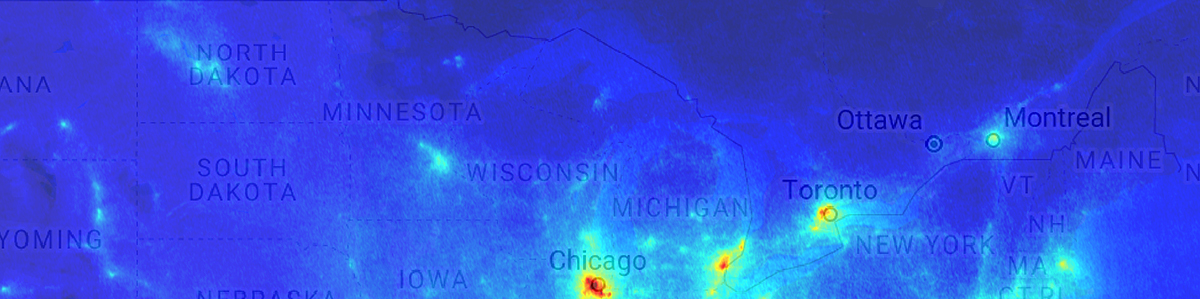
While effective at delivering big picture data, the system struggles to provide details on the amount of pollutants just above Earth’s surface — in other words, the air we’re actually breathing.
A new University at Buffalo-led study aims to provide that information across the contiguous United States. Funded by a $528,000 NASA grant, researchers will develop statistical analysis tools and physics-based algorithms to map what they call “near-surface” air pollution.
“There’s an information gap between what current satellites can tell us about air pollution and what’s really happening near Earth’s surface where we live,” says Kang Sun, PhD, research assistant professor in the UB RENEW Institute and the project’s principal investigator. “This is of immense importance because surface air quality not only affects the health of humans but also ecosystems, crops and more.”
Dan Li, PhD, an assistant professor at Boston University, will serve as the project’s co-investigator. Additional researchers represent Harvard University, NASA, the Smithsonian Astrophysical Observatory, and Atmospheric and Environmental Research, Inc.
Sun says satellites have substantially advanced the world’s knowledge of air pollution. In turn, this has led to policies that have curtailed pollution and improved human health and the natural environment.

Credit: NASA Goddard Space Flight Center.
However, most satellites provide data only in the form of a vertical column. They do not show how pollutants might vary near the surface compared to five or 10 miles above.
To obtain this data, the research team will merge satellite data with data obtained from NASA’s aircraft observational campaigns, meteorological parameters logged by commercial airlines and various atmospheric models.
The three-year project will lead to maps of surface pollutants, including nitrogen dioxide, formaldehyde, ammonia and others, over the contiguous U.S. The data will be freely available to the public.
RENEW Institute Director Amit Goyal says the project matches RENEW’s mission to find innovative solutions for complex, interdisciplinary problems affecting the environment.
“This is an excellent project aligned with the RENEW Institute’s Environmental Exposures, Genomes and Health focus area, which places a significant emphasis on addressing air pollution,” says Goyal.
Launched in 2014, the UB RENEW Institute harnesses the expertise of more than 100 faculty members from seven schools and colleges at UB. In addition to environmental issues, it also tackles energy and water issues, with a focus on developing and coordinating innovative research, education and outreach programs.
Media Contact Information
Cory Nealon
Director of Media Relations
Engineering, Computer Science
Tel: 716-645-4614
cmnealon@buffalo.edu
JOIN OUR MAILING LIST
Sign up to receive UB CSEE's electronic newsletter, delivered to your inbox!
UB will host a job and internship seminar series
Companies will be on campus regularly this semester to discuss engineering opportunities and share information applicable to all students.
View the seminar speaker schedule here
Recent Honors and Awards